Machine learning enhances drone navigation by making real-time decisions, optimizing flight paths, and guaranteeing to new data for safer operations.
It improves mapping accuracy by processing large datasets, mapping objects precisely with deep learning, and analyzing complex geographical data effectively.
In real-world scenarios, ML helps classify objects for inspections, analyze data for disaster responses, and safeguard data protection.
Challenges include gathering enough data for learning and assuring robust security measures. This transformation alters the landscape of drone technology for better precision.
Machine Learning Algorithms for Drone Navigation
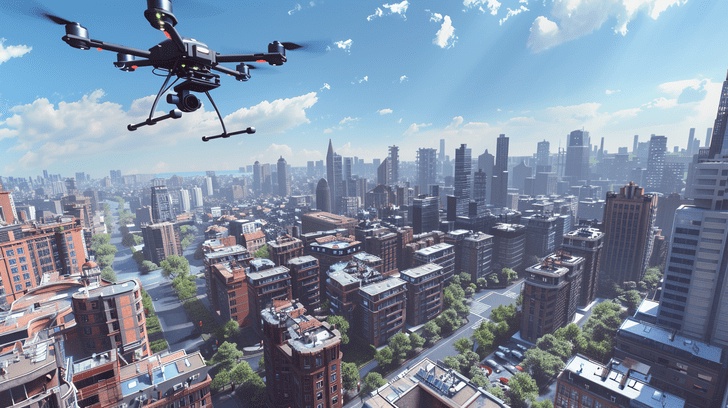
Incorporate machine learning algorithms into drone navigation systems to enhance real-time decision-making capabilities and optimize flight paths. Machine learning (ML) plays an important role in enabling drones to navigate through complex environments with efficiency and accuracy.
By utilizing path planning algorithms, drones can autonomously chart the safest and most efficient routes while avoiding obstacles in real-time. ML algorithms analyze terrain mapping data to assist drones in understanding their surroundings better, leading to improved obstacle avoidance capabilities.
These algorithms continuously learn from new data, allowing drones to adapt their navigation strategies based on changing environmental conditions.
Through the integration of ML into drone navigation systems, the overall performance and safety of drone operations can be greatly enhanced.
The ability of drones to make intelligent decisions based on real-time data not only improves their navigation precision but also ensures smoother and more reliable flight paths.
As technology advances, the role of ML in drone navigation continues to evolve, paving the way for more sophisticated and efficient unmanned aerial vehicles.
Enhancing Mapping Accuracy with ML
To boost mapping accuracy, machine learning algorithms analyze and interpret geographic data with precision and efficiency.
By utilizing neural networks, deep learning models, and image recognition techniques, drones can now gather and process vast amounts of data to create highly detailed and accurate maps for various applications.
Here's how machine learning enhances mapping accuracy:
- Increased Efficiency: Machine learning algorithms can process large datasets quickly, enabling drones to map extensive areas in a fraction of the time it would take traditional methods.
- Higher Precision: Through deep learning algorithms, drones can identify and map objects with exceptional accuracy, providing detailed information for various industries like precision agriculture.
- Improved Image Recognition: Machine learning enables drones to recognize patterns and objects more effectively, leading to more accurate mapping results.
- Enhanced Data Analysis: By leveraging neural networks, drones can analyze complex geographical data to generate thorough and precise maps for a wide range of applications.
Real-world Applications
By applying machine learning algorithms to drone mapping processes, real-world applications showcase the essential benefits of enhanced mapping accuracy in diverse industries.
Classification algorithms enable drones to identify and categorize objects in their surroundings, aiding in infrastructure inspection tasks.
Drones equipped with machine learning capabilities can swiftly evaluate the condition of bridges, buildings, and other structures, enhancing the efficiency and accuracy of maintenance efforts.
In disaster response scenarios, drones leverage machine learning to analyze real-time data and quickly assess the extent of damage in affected areas.
This enables emergency responders to prioritize their efforts and allocate resources effectively.
However, the use of machine learning in drones raises concerns about data privacy, as these devices collect vast amounts of sensitive information during their operations.
It's pivotal to implement robust data protection measures to safeguard the privacy of individuals and organizations.
Moreover, the computational requirements for running machine learning algorithms on drones pose a challenge that needs to be addressed to ensure peak performance and efficiency in real-world applications.
Challenges and Future Directions
Traversing the complexities of integrating machine learning into drone systems poses significant challenges that require innovative solutions for future advancements.
As the field continues to evolve, several key obstacles must be overcome to fully realize the potential of drones in various applications:
- Limited Data for Reinforcement Learning: Drones often operate in dynamic environments where collecting sufficient data for reinforcement learning can be challenging, hindering the development of robust navigation algorithms.
- Complexity of Simultaneous Localization and Mapping (SLAM): Implementing SLAM algorithms on drones in real-time requires high computational power and precise sensor fusion, presenting a critical barrier to achieving accurate mapping and localization.
- Integration of Satellite Imagery: Incorporating satellite imagery for large-scale mapping introduces challenges related to data processing, resolution, and synchronization with drone data, impacting the accuracy of mapping outputs.
- Ensuring Data Security: With drones collecting vast amounts of sensitive data, ensuring robust encryption, authentication, and secure communication channels is vital to prevent unauthorized access and protect privacy. Addressing these challenges will be pivotal in shaping the future directions of drone technology.
Frequently Asked Questions
How Do Drones Navigate in Adverse Weather Conditions Using Machine Learning Algorithms?
In adverse weather conditions, drones use machine learning algorithms to adapt their navigation. These algorithms analyze real-time data to adjust flight paths, optimize routes, and maintain stability, ensuring safe and efficient operations despite challenging environments.
What Privacy Concerns Arise When Drones Are Used for Mapping With ML Technology?
When drones soar over your privacy, concerns bloom like flowers in spring. Mapping with machine learning may inadvertently capture sensitive data, heightening worries about surveillance and data security. Safeguards are essential for trust to take flight.
Can Machine Learning Algorithms Help Drones Navigate Through Complex Urban Environments With Obstacles?
Yes, machine learning algorithms can greatly enhance drone navigation in complex urban environments with obstacles. By leveraging data patterns, drones can autonomously adjust flight paths and avoid collisions, enabling safer and more efficient operations.
How Do Drones Utilize Reinforcement Learning for Autonomous Navigation and Mapping Tasks?
To navigate and map autonomously, drones leverage reinforcement learning algorithms. By continuously learning from interactions with the environment, drones improve decision-making for complex tasks, adapting their navigation strategies based on feedback received during their missions.
What Are the Limitations of Current Machine Learning Techniques in Improving Drone Navigation and Mapping Accuracy?
Current machine learning techniques have limitations in drone navigation and mapping accuracy. You'll encounter challenges like data scarcity, generalization issues, and real-time processing demands. Overcoming these hurdles is essential for enhancing drone performance.
Conclusion
In summary, machine learning plays a vital role in enhancing drone navigation and mapping capabilities. Like a skilled cartographer charting unexplored territories, ML algorithms enable drones to navigate complex environments with precision and accuracy.
As technology continues to advance, the potential for drones equipped with machine learning to revolutionize industries such as agriculture, construction, and disaster response is vast. Embracing these advancements and addressing challenges will be key to unleashing the full potential of drone technology.

No comments yet