The significance of hyperspectral imagery is rapidly increasing, especially in the forestry industry. It has become a vital tool for understanding and managing forest ecosystems. In today's world, where environmental sustainability and resource management are crucial, hyperspectral imaging offers a new perspective for preserving our natural world.
The rise of commercial hyperspectral imaging satellites, such as those from Pixxel, plays a crucial role in improving sustainable forestry practices. These satellites not only collect valuable data but also pave the way for more effective and informed forest management that promotes sustainability.
What is Hyperspectral Imagery?
At its core, hyperspectral imagery is a technology that expands our visual capabilities beyond human limits. By capturing the full electromagnetic spectrum in multiple narrow bands, hyperspectral imaging reveals intricate details and spectral signatures that are invisible to the naked eye. With over a hundred bands, this advanced imaging technique provides unique fingerprints for every object or material on Earth. It does so by analysing how light reflects off surfaces, allowing for precise identification of different elements and conditions.

Visual representation of the voluminous dataset in hyperspectral imagery compared to conventional techniques (Source).
The power of HSI lies in its ability to capture not just the visible spectrum but also the near-infrared and shortwave infrared ranges. This comprehensive coverage enables the detection of various aspects including changes in plant health before they become noticeable.
Challenges in Forest Management
The field of forestry requires solutions to maintain the longevity of our forests. To address these issues, advanced forestry technology has become crucial, with hyperspectral imaging and remote sensing being at the forefront.
By providing the highest resolution satellite imagery, empowers forestry experts and land managers with the necessary insights to tackle the complexities of modern forest management.
The decline in biodiversity is a major concern for the forestry industry. A diverse range of species is essential for maintaining ecological balance in our forests. The widespread adoption of monocultures has led to a significant reduction in natural habitats for diverse flora and fauna. Better forest management solutions are essential to mitigate these detrimental impacts.
Invasive species are another significant threat to forests worldwide partly due to climate change, they can alter ecosystem dynamics and harm overall forest health. An instance of this is the increasing occurrences of beetle infestations in the northern hemisphere, destroying vast forest areas.

Model of the probability of bark beetle infestation under historical temperature conditions and warmer scenarios (Source).
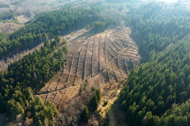
Illegal logging remains an ongoing issue, undermining sustainable forest management efforts, and leading to extensive deforestation, habitat destruction and loss of valuable resources.
Climate change and human activities have resulted in more frequent and severe forest fires. These fires destroy timber resources and have adverse environmental consequences. To mitigate fire risks, strategies for sustainable land use, fire prevention and suppression are essential.
To overcome these challenges, sustainable forestry management is crucial. Striking a balance between meeting the growing demand for forest resources and preserving the long-term health of ecosystems is a hard task. Using advanced forestry technology to promote sustainable practices that integrate conservation and economic viability is key.
Hyperspectral Imagery in Forest Management
As the field of forestry continues to evolve, precision and data-driven decision-making have become crucial. Hyperspectral imaging has emerged as a revolutionary tool in this industry, providing a comprehensive view of forests and aiding in the detection, classification, and quantification of essential parameters.
One significant application in forest management is species classification. By analysing the distinct spectral signatures of different tree species, hyperspectral imagery enables the identification and mapping of various trees within a forest. This information is vital for preserving biodiversity and maintaining a healthy ecosystem.

Tree species classification using hyperspectral data (Source).
Monitoring the health of forest vegetation is also critical for early intervention. Hyperspectral imagery can detect vegetation stress caused by factors like water scarcity or nutrient deficiencies. This capability allows forest managers to take prompt action to address issues before they escalate.
Hyperspectral imaging plays a crucial role in identifying and managing diseases that can devastate entire ecosystems if left unchecked. By detecting spectral anomalies in tree canopies, rapid disease detection enables targeted intervention and minimises their spread.
Another significant benefit of hyperspectral imagery is its ability to identify invasive species, especially in areas where commercial forestry occurs near natural forests. Invasive species can be transported on new trees or machinery, posing a threat. Early detection enables precise management strategies, minimising the impact of these invaders on native ecosystems.
Through the use of hyperspectral imaging satellites, forest management professionals can develop sustainable strategies that promote both environmental preservation and long-term forest health. As we continue to explore the applications of hyperspectral imaging and advanced forestry technology, we will discover even more ways in which these tools contribute to a brighter and more sustainable future for the forestry industry.
Operational Benefits of Hyperspectral Imaging Satellites
Hyperspectral imaging satellites offer a range of operational benefits that are revolutionary in how we approach forestry:
Comprehensive Data: Hyperspectral imagery satellites' primary strength is their ability to capture a holistic view of forested areas. With the capability to gather a wide range of spectral information, these satellites provide forest managers with the most comprehensive data for making well-informed decisions.
Environmental Insights: This technology provides valuable insights into the environmental conditions of forests, which is essential for promoting sustainability in forestry practices. By monitoring factors like stress, diseases and environmental changes these satellites contribute to a deeper understanding of the dynamics of forest ecosystems.
Efficient Resource Allocation: This is a key in forest management, and hyperspectral imaging technology plays a significant role in optimising it. By identifying areas that require immediate attention, such as disease outbreaks or invasive species infestations, forest managers can allocate resources more efficiently, reducing costs and maximising their impact.
Cost-Effectiveness in Forest Management: Traditional methods of data collection often involve time-consuming and labour-intensive fieldwork. Hyperspectral imaging satellites eliminate the need for extensive ground surveys, significantly reducing operational costs while providing comprehensive coverage of larger areas in a single image.
Improved Image Quality: Companies like Pixxel, have satellites that are known for providing highest resolution satellite imagery. This enhanced image quality allows researchers and forest management professionals to gain deep insights into forest structure, health, and dynamics with unmatched precision.
The Future of Forestry Management
The operational benefits of Hyperspectral Imaging Satellites are undeniable. They give forest management professionals access to high-quality data with better cost-efficiency.
This technology is reshaping the approach to forest management solutions and positioning Pixxel as a key player in the industry of commercial hyperspectral imaging satellites.
If you're interested in learning more about how Pixxel's technology can enhance your forest monitoring strategies. Contact Pixxel for a deeper understanding of our advanced remote sensing capabilities tailored to your organisational needs.

No comments yet